
Echo Lake, N. Conway (Easy with tranquil views)
N. Conway to River Rd. Left on West Side Rd, right about 1/4 mile to Echo Lake sign on right. Start at west end of inside parking lot. Trail surrounds lake. Share with XC skiers and hikers.
Black Cap, N. Conway (1.2 miles - 1 hr/1 way - easy)
Trail begins at height of land on south side of Hurricane Mt. Rd. Awesome views of the Green Hills & Mt. Washington Valley. Just before ledges, trail continues right to Mt. Cranmore (1.2 miles, 1 hour). Hurricane Mt. Rd. closed in winter.
Mt. Chocorua (2737’) Albany, NH. Take Rt. 16 S. On right is Piper Trail and parking lot. Easier access from Champney Brook Trail off Kanc. Large parking area. Check hiking guides before choosing. Steep sections.
Diana’s Bath, N. Conway (1/2 mile walk to rocky cascades. Parking off West Side Rd.
South Doublehead, Jackson (approx. 1.5 miles, 2 hrs/1 way - moderate to steep)
Rt. 16B past Black Mt. Ski Area, turns into Dundee Rd. Trailhead about 1/4 mile on left. From parking lot take Doublehead Ski Trail .6 miles to start of Old Trail on right, then .6 to New Trail jct. Go right on New Trail, easy climb .2 miles to peak. Loop options, but for easy return, descend the same route. Great views.
Mt. Willard Trail, Crawford Notch (1.4 miles - 1.25 hours/1 way - family favorite)
Trail starts Crawford Notch Info Ctr. west side, Rt. 302. Awesome view from ledges.
Mt. Eisenhower, Twin Mt. (3.2 miles - 2 hrs. 40 min.)
Edmand’s Path, Rt. 302. From east side of Mt. Clinton Rd. to summit of Mt. Eisenhower. One of the easier trails onto the Presidentials.
Echo Lake Beach & RV Park
Franconia notch Exit 34C off Rt. 93. Views & walking trails.
Lincoln Woods, Lincoln (approx. 3.5 miles - 2 hrs/1 way - easy)
Off the Kancamagus. Hike or mt. bike to amazing swimming hole & waterfall. From parking lot go to Forest Service cabin for maps to river and brookside trails.
Red Hill, Center Harbor (1.7 miles - 1.5 hrs/1 way - family friendly)
Turn onto Bean Rd. at Jct. Rts. 25 & 25B in Ctr. Harbor. Approx. 1.5 miles turn onto Sibley Rd. at first sign for Red Hill Fire Tower. Parking & trail identifiable despite no sign.
The Dells, Littleton (easy walk)
Off Rt. 18, 1.2 miles NW from Post Office, 2nd entrance off Dells Rd. Easy to follow trails around pond. Picnic tables, fireplaces, fishing for children only. Great bird watching.
Kilburn Crag, Littleton (1 mi. R-trip, 1 hr.)
Rt. 18, outside Littleton. Easy climb to breathtaking view of town & White Mt. peaks.
Falling Waters Trail
Franconia Notch Trail starts opposite Lafayette Campground. 3 waterfalls along easy lower section: Stair Falls and Swiftwater Falls at 0.9 mile and stunning Cloudland Falls at 1.4 miles.
Table Rock, Dixville Notch
Not for the faint of heart. The vertical slabs are less than 10 ft. wide at the narrowest jutting100 ft. from the north side of Mt. Gloriette. Accessed from Table Rock Trail parking lot east of the Balsams. Two trails. One easy and longer, one a steep 0.3 mile path to the rock. Excellent views.
Lake Francis Trail
Rt. 3 or rt. 145 into Pittsburg Village. Go north on Rt. 3 approximately 5 miles to River Rd. on right. Follow to Carrs Ridge Rd . After bridge, take first right onto grassy snowmobile lane. Follow 3 miles to the Cedar Stream Rd. Pretty, 6 mile view of Lake Francis.
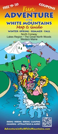
advertisers
![]()