
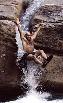

CAUTION: All rocks slippery when wet!
Agassiz Basin Rt. 112, 1.5 mi. west of Rt. 3, N. Woodstock. Small but really pretty waterfall.
Arethusa Falls, Crawford Notch (1.3 miles - 1 hr/1way. Easy - moderate) Parking lot on west side of Rt. 302. Cross railroad, continue left 50 yards, turns right into woods. Trail follows north bank of Bemis Brook and reaches Arethusa Falls, the highest in the state at 200’.
Beaver Brook Falls, Colebrook Rt. 145, 1 mi. north of Colebrook on right side of road. View from your car. Nice spot. Swim or walk.
Bridal Veil Falls Off 116 near Easton to Coppermine Rd. 80’ falls are 2.5 mile hike in. Can be viewed both above & below.
Champney Falls, Conway (1.5 miles - 1 hr/1 way - family friendly) Trail begins 10 miles west of Saco Ranger Station on Kancamagus Highway. All falls are dramatic in spring and after heavy rains, but diminish during dry spells.
Crystal Cascade, Pinkham Notch (.3 mile from AMC Pinkham Notch base camp) Off Rt. 16. Dramatic 80’ high falls with two drops. Easy to moderate hike in.
Diana’s Bath, N. Conway (.5 mile-25 mins./1 way - family friendly) River Rd. to West Side Rd., .7 mile north of Echo Lake sign. Parking lot on left. Follow signs to falls.
Dixville Notch Flume & Huntington Cascade On either side of Rt. 26, east of the scenic Notch. Picnic area.
Georgiana Falls, Lincoln - On Harvard Brook accessed by unmarked trail leaving parking area off Hanson Farm Rd. Easy 1.3 mile hike to Lower Falls. Upper/Harvard Falls, a steep .5 mile farther.
Glen Ellis Falls, Pinkham Notch (.2M) Pinkham Notch, Rt. 16 south of AMC & Wildcat. Parking & pedestrian tunnel, turn right for hike to 65’ falls.
Jackson Falls/Wildcat River, Jackson Village Off Rt. 16 to 16A, to Carter Notch Rd. Very assessible, swimming, picnic area. “Wild & Scenic River”
Ripley Falls, Crawford Notch Rt.302, 1M south of Willey Historic Site. 100’ falls and pools
Sabbaday Falls Located off Rt.112 Kancamagus Hwy. 17 miles west of Conway. Gorges and 3 tiered falls. Easy 15 min. hike. Walking bridges, pools & picnic area.
Silver & Flume Cascades, Crawford Notch Rt. 302 north of Bartlett. Can be seen from car or hike up sides for closer view. Scenic Notch area.
advertisers
![]()